Technology
We are committed to keeping up with the changing technology driven business environment and continually upgrade our industry standard software and surveying tools.
Some of the equipment and tools we use are:
- The Trimble VX™ Spatial Station
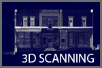
- The Trimble VX captures survey-precise ground-level data that fuses with images to produce a complete 3D deliverable.
- Realworks 3D Software with Modeling
- Trimble® GPS
- Robotic Total Station
- Conventional Total Station
- Differential Leveling
- Industry Standard Autodesk® Civil and Land Desktop Cad Drafting Software


